We have updated our Privacy Policy Please take a moment to review it. By continuing to use this site, you agree to the terms of our updated Privacy Policy.
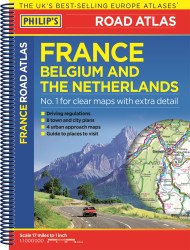
Philip's Handy Road Atlas France, Belgium and The Netherlands

On sale
3rd June 2021
Price: £6.99
Philip’s Handy Road Atlas of France, Belgium and The Netherlands features new digital cartography voted Britain’s clearest and most detailed European mapping in an independent consumer survey. This glove-box size, compact A5 atlas with lie-flat binding is perfect for travelling across France and the surrounding countries.
Philip’s Road Atlas France, Belgium and The Netherlands shows the national road networks at a scale of 1:1 million, with ultra-clear, detailed mapping for urban areas. All the scenic routes are clearly highlighted, and the maps show huge numbers of places to visit including beaches, theme parks, national parks and World Heritage Sites.
Alongside the easy-to-read, bestselling mapping is:
* Special route-planner spread
* Listings for ski resorts and top visitor attractions;
* Summary of driving regulations in France, Belgium and the Netherlands
* Pages of clear, detailed road maps, with car ferries and toll, toll-free and pre-pay motorways all clearly marked
* Large-scale approach maps for four major cities (Bordeaux, Lyon, Paris, Strasbourg) to avoid jams
* City-centre plans marking historic buildings and tourist attractions as well as car parks, head post offices and other facilities in eight major cities (Amsterdam, Brussels, Bordeaux, Luxembourg, Lyon, Marseilles, Paris, Strasbourg).
Newsletter Signup
By clicking ‘Sign Up,’ I acknowledge that I have read and agree to Hachette Book Group’s Privacy Policy and Terms of Use